Aerial Mapping & Surveying: A Complete Guide for Property Owners
From topographic surveys to boundary mapping, learn how drone technology delivers survey-grade accuracy at a fraction of traditional costs. Essential reading for landowners and developers.
Chris Patterson
FAA-Certified Drone Pilot
Understanding Drone-Based Surveying
Aerial mapping and surveying using drones represents one of the most significant advances in geospatial technology. What once required days of ground-based measurements can now be accomplished in hours with centimeter-level accuracy.
Types of Aerial Surveys
- Topographic Surveys: Detailed elevation data showing land contours and terrain features
- Boundary Surveys: Visual documentation of property lines and features
- Volumetric Surveys: Precise measurement of stockpiles, excavations, and fill areas
- Orthomosaic Mapping: Geometrically corrected aerial photos that can be used for measurements
- 3D Modeling: Detailed three-dimensional representations of terrain and structures
How Drone Surveying Works
The process involves several key steps:
- Ground Control Points (GCPs): Survey markers placed on the ground provide reference coordinates for accuracy
- Flight Planning: Software calculates optimal flight paths for complete coverage
- Image Capture: The drone captures hundreds of overlapping photos with GPS data
- Processing: Specialized software stitches images into maps and 3D models
- Deliverables: Final products are exported in industry-standard formats
Accuracy & Precision
Modern drone surveying achieves remarkable accuracy:
- Horizontal accuracy: 1-3 cm with GCPs
- Vertical accuracy: 2-5 cm with GCPs
- Without GCPs: 1-3 meter accuracy using GPS alone
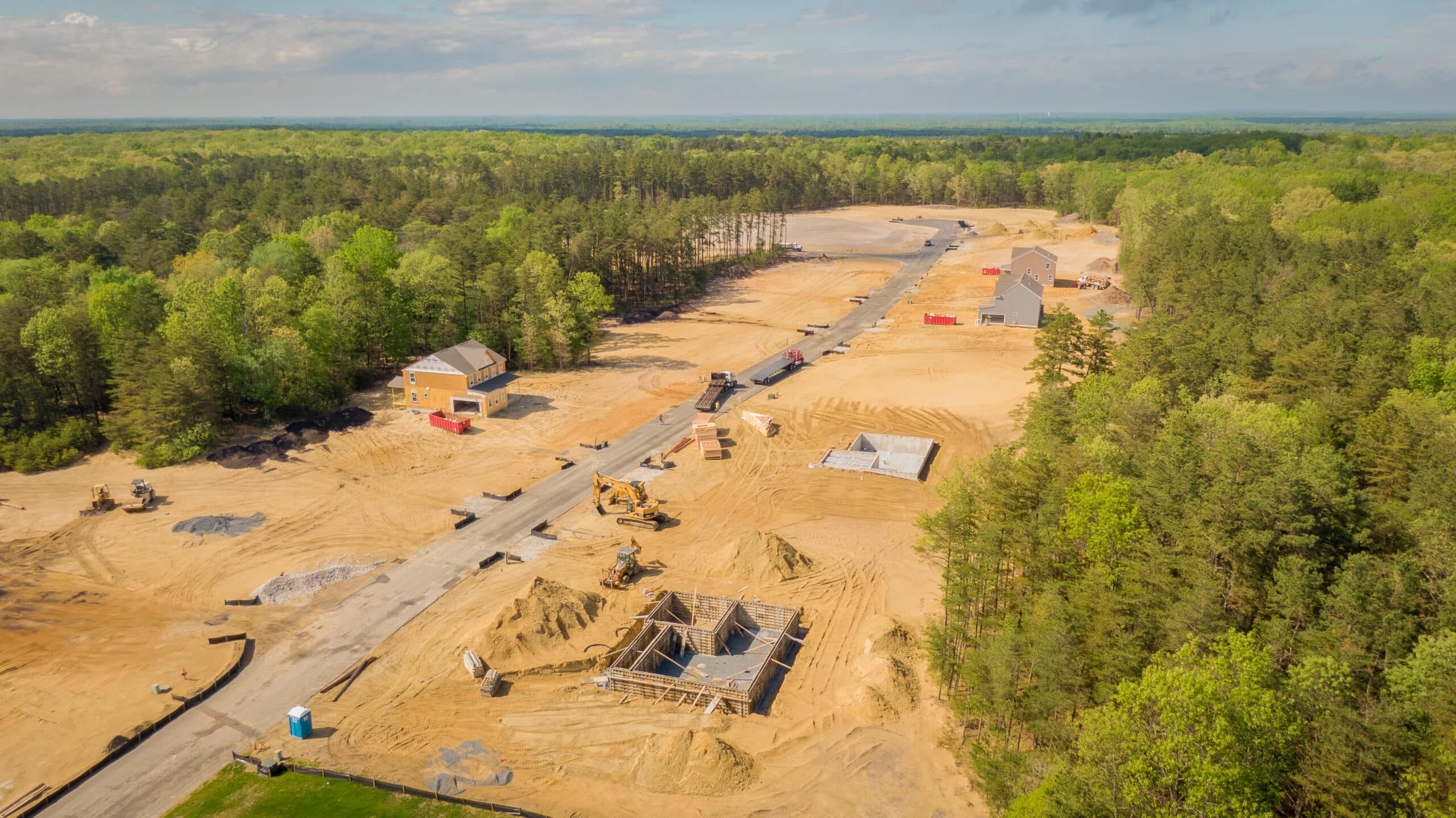
Common Use Cases
- Pre-construction site planning
- Land development feasibility studies
- Agriculture field mapping
- Environmental assessments
- Stormwater management planning
- Historical documentation
Deliverable Formats
Our surveys can be delivered in various formats:
- GeoTIFF: High-resolution georeferenced images
- LAS/LAZ: Point cloud data for 3D analysis
- DXF/DWG: CAD-compatible formats
- KML/KMZ: Google Earth compatible files
- Contour Maps: Traditional topographic representations
"The drone survey of our 40-acre parcel was completed in one day. The same work would have taken a traditional survey crew over a week." - Land Developer, Pierce County
Cost Comparison
Drone surveying offers significant cost advantages:
- Traditional survey: $500-2,000 per acre
- Drone survey: $100-400 per acre
- Time savings: 50-80% faster than ground-based methods
Ready to map your property? Contact CAAP Solutions for a custom quote based on your acreage and requirements.
Need Professional Drone Services?
Let CAAP Solutions handle your next aerial project with FAA-certified expertise.
Get a Free Quote